谷歌地球(google earth)中路径距离的量测具体方法
时间:2022-10-26 16:11
很多的用户都在使用谷歌地球,你们知道怎么使用它量测路径距离吗?下文就是谷歌地球(google earth)中路径距离的量测具体方法,希望大家喜欢。
谷歌地球(google earth)中路径距离的量测具体方法

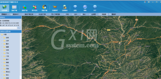
首先我们打开谷歌地球,没有的用户可以先下载
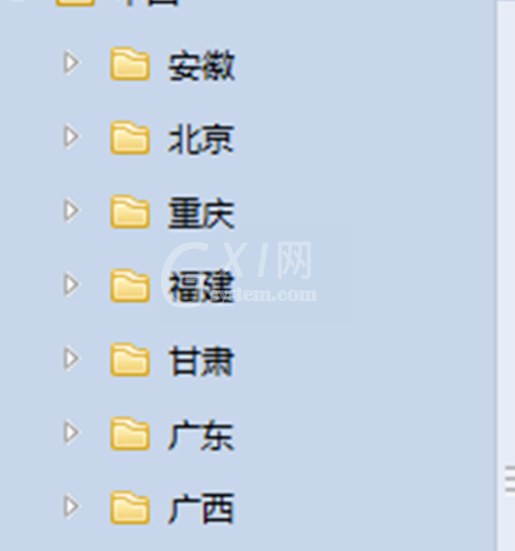
然后我们从最左侧选择我们需要测量地方的国家或省份
之后点击上方更能区域的”测距离“

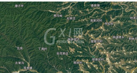
鼠标左键和滚轮调整地图的位置和缩放大小,找到所需的位置
鼠标左键点击测距离的起点,之后根据路径将路径用测距画出来,主要不要重复,要一点点的画出
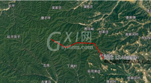
这时画完后,就会显示出我们测的路径的距离
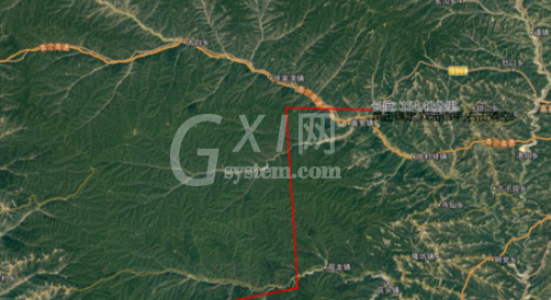
最后我们按鼠标右键,可以将我们测距的数据清空,确定即可

以上就是谷歌地球(google earth)中路径距离的量测具体方法,你们是不是都明白了呀!


热门排行
今日推荐


热门手游
-
商场购物模拟器官方版

版本:v1.0.9
大小:46.11MB
日期:2024-12-16
-
滚动方块大冒险免费版

版本:v1.0.5
大小:26.10MB
日期:2024-12-16
-
恋恋奇缘体验服版

版本:v1.0.0
大小:131.33MB
日期:2024-12-16
-
炉石传说官方正版

版本:v1.0
大小:100.52MB
日期:2024-12-16
-
人群大师免费版

版本:v2.15.0
大小:57.68MB
日期:2024-12-16
-
方鸡跳跑单机版

版本:v1
大小:63.49MB
日期:2024-12-16